[vc_row][vc_column][vc_column_text]
The 100-Mile Circle
[/vc_column_text][vc_single_image image=”647″ img_size=”500×500″ alignment=”center” style=”vc_box_rounded” onclick=”img_link_large”][gap size=”20px” id=”” class=”” style=””][vc_column_text]
About the Location
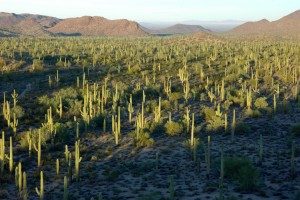
The 100-Mile Circle is extremely diverse topographically, geologically, climatically, and biologically owing to its elevational range of about 1,050 feet along the bed of the Gila River near Phoenix to 10,720 feet atop Mount Graham in the Pinaleño Mountains, but also due to a confluence of biomes including the Sonoran Desert, tropical influences from the south, the Rocky Mountains, the Sierra Madre Occidental, the Great Plains, and the Chihuahuan Desert. Biotic diversity is further enhanced by a “Sky Island” phenomenon in which mountain ranges rise up from the valley grasslands and deserts, forming relatively mesic and wooded ecological islands, often with unique species or subspecies.
Downtown Tucson is at an elevation of 2,389 feet, but the town is ringed by mountain ranges. On the north side are the Santa Catalinas, topping out at 9,157 feet. The Santa Ritas, to the south, are just a little taller (9,453 feet), and the Rincons on the east are a little shorter. Other prominent mountain ranges in the 100-mile circle include, in Arizona, the Baboquivari/Quinlan, Sierrita, Santa Rosa, Picacho, Table Top, Pinal, Whetstone, Galiuro, Patagonia, Huachuca, Dragoon, Mule, Winchester, Pinaleño, Gila, Santa Teresa, and Chiricahua mountains, and the Sierra Estrella. In Sonora the Sierras Cibuta, Los Pinitos, Azul, Mariquita, Los Ajos, and San Jose are the most prominent mountain ranges within the Circle.
Between these often rugged ranges are valleys, some which support, or used to support flowing streams and rivers, as well as boggy springs known as ciénegas. The Santa Cruz, Avra, Altar, San Pedro River, Sulphur Springs, and Gila River valleys in Arizona, and the Río Bambuto and Río Cocóspera valleys in Sonora are among the more biologically important. Habitats produced by this topographical mixture are highly variable, as would be expected.
Elevation plays an important role, but so do rain-shadow and wind-shadow effects, the direction a slope faces, the geology and hydrology of any particular place, as well as its deep geological and climatic history. Temperatures are generally higher and precipitation less in the western portions and lower elevations of the Circle as compared to the eastern mountains and higher valleys, where the climate is cooler and wetter. Precipitation is bimodal, with gentle, widespread winter rains occurring from about November to March and often violent and localized storms, known as summer monsoons, from late June or early July through early September.
[/vc_column_text][gap size=”20px” id=”” class=”” style=””][/vc_column][/vc_row][vc_row][vc_column][swmsc_text_block id=”” class=”” style=””]
Habitats Within the ‘100-Mile Circle’
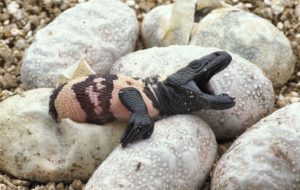
The diversity of biotic communities within the 100-mile Circle, from Sonoran Desertscrub to Spruce-fir Forests atop the Chiricahua and Pinaleño Mountains — and everything in between — supports the wealth of reptile and amphibian populations in our region. Learn more . . .
[/swmsc_text_block][gap size=”20px” id=”” class=”” style=””][vc_column_text]
Using THS Images
All images related to the reptiles and amphibians in the gallery and elsewhere on this website are copyrighted. Any copying, use, or reproduction of these images without the expressed permission of the photographer is a violation of copyright law.
If you want to use any of the images please contact the website administrator.
He or she will put you in touch with the photographer, who will probably have no issue with using them for private, non-commercial, educational purposes. It is important to respect the artists who gave us these wonderful photographs.[/vc_column_text][/vc_column][/vc_row]